


Earth Map: Live Satellite View
2.94.00 Reviews
App Specs
- Version
- 2.2.9
- Updated On
- License
- Free
- Downloads
- 100,000+
- Developer
- PerfectSolution
- Categories
- Maps & Navigation
- Platform
- Android
Screenshots
 Analysis by AppCompare
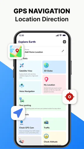
I installed Earth Map: Live Satellite View expecting a quick way to explore the planet from a different angle, and that is exactly where its first appeal lies. It combines an earth map, satellite imagery, GPS voice navigation, a three-dimensional map view, and a GPS camera in one free Maps & Navigation app. The mix feels more interesting than a plain street map because it invites you to look around even when you are not actively trying to reach an address.
That novelty is useful, but it also raises an important question: does this app become part of your routine, or does it remain something you open a few times and then forget? After spending time with the main tools, I think the answer depends heavily on what you want from navigation. If you need a familiar, dependable route planner for daily driving, the usual established alternatives are easier to trust. If you enjoy satellite exploration, visual orientation, and having several map perspectives in one place, Earth Map has a more distinctive role.
What the first week feels like
The first sessions are naturally exploratory. I moved between the earth view, satellite imagery, three-dimensional presentation, and GPS-related tools to understand how the app wants to be used. The experience is less about entering a destination and immediately following a conventional route, and more about combining visual context with location awareness. That makes it appealing for checking an unfamiliar area before travelling or simply understanding how a place sits in its wider surroundings.
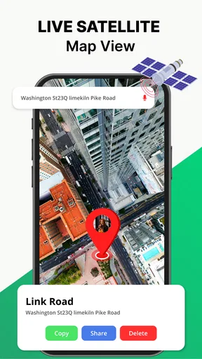
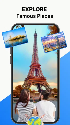
The satellite view is the feature most likely to bring me back during the first week. A standard map is excellent for labels, roads, and instructions, but satellite imagery can answer different questions. It can help me recognize the shape of a coastline, see how a neighbourhood is arranged, or understand the relationship between roads and open land. I would not treat the imagery as a substitute for official local information, but it adds a useful visual layer when a line map feels too abstract.
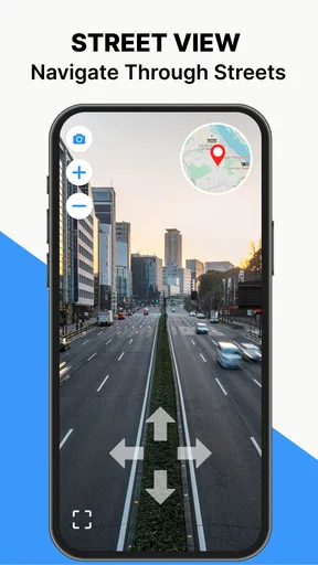
The three-dimensional map view also contributes to that early sense of discovery. It is particularly helpful when I am trying to form a mental picture of terrain or urban layout rather than merely follow a highlighted route. The benefit is strongest when I pause and inspect an area before moving, because the extra perspective can make a place easier to remember. It is less valuable when I only need the fastest possible turn-by-turn answer.
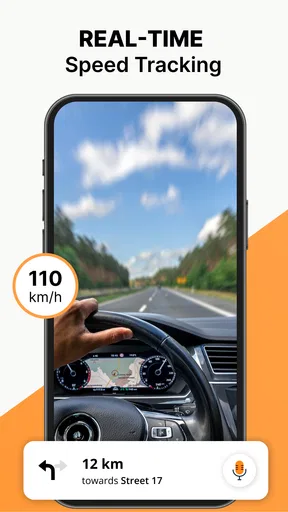
Voice navigation changes the app from an exploration tool into something I can use while moving. In practice, I would set up the route before starting a journey, place the phone securely, and let the spoken guidance reduce the need to keep looking at the screen. That workflow matters: the visual features invite interaction, but safe navigation requires preparing first and avoiding map browsing while driving.
The GPS camera is another feature that makes the app feel different from a basic navigation utility. I see it as a way to connect the camera view with location information, especially when I am outdoors and want a more immediate sense of where I am. Its value is situational rather than constant. It is most interesting during walks, sightseeing, or location-based exploration, not necessarily during every commute.
Worth Reading Before You Choose

EA SPORTS FC Mobile 26 Is a Bigger Football Game, but It Takes Time

Flipboard Shows What News Apps Must Do Beyond the Feed

Switching to Android Auto Means Rethinking Your Driving Routine

Google Calendar Makes a Crowded Week Easier to Manage

Ludo King Makes the Most of the Minutes Between Plans

Baby Panda World Brings Quick Play to Modern Phones, but Its Game Library Feels Busy
Earth Map is free to install, which makes this first-week testing easy to justify. The app is available to users aged Everyone, and it runs on Android devices using version 8.0 or later. The developer is PerfectSolution, and the current version is 2.2.9. Those details make the entry barrier fairly low for someone who wants to try the satellite and camera approach without committing to a paid download.
Where it helps in everyday life
A realistic use case is planning a visit to a large unfamiliar area. Before leaving home, I can inspect the destination in satellite view, switch to a more conventional map perspective for roads, and then use voice navigation during the journey. Once I arrive, the three-dimensional view or GPS camera can help me orient myself more naturally than a flat line on a screen. The useful part is not any single mode; it is the ability to move between perspectives as the situation changes.
Another practical example is checking a route before a walk. I might want to know whether a path appears to pass through a dense built-up area, open space, or a complicated cluster of roads. Satellite imagery gives visual clues that ordinary map symbols may not communicate immediately. I would still confirm access, opening conditions, and local restrictions elsewhere, but the app can make the initial planning stage more concrete.
For travel preparation, I found it better as a visual companion than as the only source of information. I can use it to understand the shape of a destination and then rely on local signs or a more established navigation service for details that need to be current and precise. That division of labour is important because attractive imagery can create a feeling of confidence that is not always the same as verified, real-time road knowledge.
How it compares with ordinary navigation apps
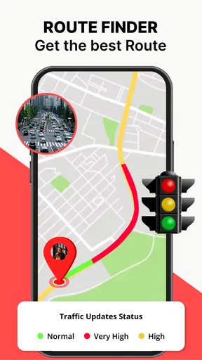
The comparison with mainstream map applications is not simply about which one has more features. Familiar navigation apps usually win when I need polished address search, predictable route planning, traffic-aware decisions, saved places, transit information, or a large ecosystem of local details. They are built around repeated daily tasks, so their strongest quality is often consistency rather than visual novelty.
Earth Map takes a different position. Its strongest identity comes from combining satellite exploration, a three-dimensional view, voice guidance, and a GPS camera. That combination can feel more engaging when I want to inspect a place rather than just pass through it. It is a better fit for someone who thinks visually and enjoys switching perspectives. It is a weaker fit for someone who wants one familiar screen, minimal interaction, and the shortest path from search box to destination.
I would also avoid choosing it solely because the store summary sounds comprehensive. Several tools in one app do not automatically make every tool equally central to a daily routine. During my testing, the satellite and visual exploration aspects gave it personality, while voice navigation supplied the most obvious practical function. The camera was more dependent on the occasion. That balance is worth understanding before replacing an app that already handles everyday navigation well.
What remains useful after the novelty
The first-week excitement comes from seeing the world differently. The month-to-month question is whether I have recurring reasons to open it. For me, the answer is yes, but in a narrower way than the initial feature list suggests. I can imagine returning to it when planning a trip, checking the layout of an unfamiliar destination, comparing map perspectives, or using the GPS camera during an outdoor visit. Those are genuine repeatable scenarios, even if they are not daily habits.
The app becomes more valuable when I give each mode a specific job. I use satellite imagery for visual context, the three-dimensional view for spatial understanding, voice navigation for hands-free guidance, and the GPS camera for a more immediate outdoor perspective. Treating the modes as separate tools prevents the experience from becoming a vague tour of buttons. It also helps me decide quickly whether opening the app is worthwhile for the task in front of me.
One non-obvious advantage is that visual planning can reduce the mental effort of remembering a route. If I first examine the surrounding layout instead of memorizing a sequence of turns, I may arrive with a better sense of how the destination relates to nearby roads and open areas. This will not replace spoken directions, but it can make the journey feel less like following an invisible line and more like understanding the place.
A second useful workflow is to use the app before, during, and after a trip in different ways. Before leaving, I inspect the destination. During travel, I keep attention on voice guidance rather than repeatedly manipulating the map. After arriving, I can use the visual tools to explore the area more freely. This separation makes the app safer and less tiring than trying to use satellite browsing and active navigation at the same time.
A third trade-off is that the app’s broad feature mix may be more valuable to curious users than to heavy commuters. Someone who takes occasional road trips, enjoys geography, or regularly visits unfamiliar places can get recurring value from the visual layers. Someone whose only need is a reliable work commute may find that the extra perspectives do not justify changing established habits.
How often I would actually return
I would not expect Earth Map to become the app I open automatically every morning. Its lasting value is episodic: it earns a place on my phone because certain situations make its combination of views convenient. That can still be worthwhile. A tool does not need to be used every day to be useful, especially when it helps with travel planning or orientation in places I do not know.
The average rating is 2.9 from over two hundred ratings, so I would approach it with realistic expectations rather than assuming that every part of the experience will feel equally polished. The presence of over one hundred thousand installs shows that it has attracted a meaningful audience, but popularity alone does not settle whether it fits my needs. I would judge it by the specific tools I expect to use, not by the install figure.
There are also in-app purchases ranging from $5.99 to $49.99 per item. Because the app is free to start, I would spend time with the basic experience before considering any purchase. The right question is not whether an extra option sounds attractive, but whether it solves a limitation I have personally encountered often enough to matter. For occasional exploration, the free entry point may be enough; for frequent use, I would examine the purchase screen carefully before paying.
The maintenance burden over time
Any navigation app creates a small maintenance routine, even when that routine is invisible. I need to keep the app updated, check that my phone is ready before a journey, and avoid discovering a problem only after I have started moving. Earth Map’s current version is 2.2.9, and keeping software current is sensible when using navigation or location features. I would also make sure the phone has enough battery and a stable setup before relying on voice guidance.
The biggest maintenance burden is not necessarily tapping an update button; it is managing expectations. I would not plan a complicated journey using only one map source. Before setting off, I would inspect the route, confirm the destination, and keep an alternative navigation option available for situations where the visual view is less useful. This is especially important when timing, road conditions, or local access details matter more than satellite context.
There is a practical habit that makes the app easier to live with: decide in advance which view you need. If I open the app without a purpose, I can spend time switching between attractive perspectives without making progress. If I begin with a simple question—“What does this area look like?” or “How do I get there hands-free?”—the app feels more efficient. That small discipline reduces the friction of a feature-rich interface.
I would also treat the GPS camera as a tool to use deliberately rather than leave active throughout a day. Camera-based location experiences can be engaging, but they make more sense during a specific walk or sightseeing session than as a permanent navigation habit. Using it at the right moment keeps the feature memorable instead of turning it into another screen demanding attention.
Where fatigue can set in
The first source of fatigue is feature overlap. Satellite imagery, three-dimensional mapping, GPS camera functions, and voice navigation each suggest a different style of use. That breadth is attractive, but it can make the app feel less focused than a dedicated navigation service. When I am in a hurry, extra choices are not automatically helpful; they can slow down the simple task of finding a route.
The second source is the difference between visual confidence and navigational certainty. A satellite image can look clear while still being an imperfect guide to what is accessible, current, or officially open. I would never assume that a visible track is a public road or that an apparent entrance is available. The app is strongest when I use it for orientation and planning, then verify important practical details through appropriate local sources.
The third issue is attention. An earth map and a GPS camera encourage looking around, while voice navigation is designed to let me focus on movement. Those goals can conflict if I try to explore while driving. My rule would be simple: prepare the visual exploration before departure, then use voice guidance and keep interaction to a minimum while on the road.
There is also a risk that the app becomes a novelty drawer. I may enjoy opening it to inspect a new location, but if I do not travel often or care about geographic exploration, the recurring reason to return becomes weak. In that case, a conventional map app with stronger everyday search and routing tools is likely the better long-term choice.
Who should install it, and who should skip it
I would recommend Earth Map to visually minded travellers, casual explorers, students of geography, and anyone who likes understanding a destination before arriving. It is also worth trying for people who want voice navigation alongside a more immersive map experience. The free price makes experimentation reasonable, especially for users whose phones meet the Android 8.0 minimum requirement.
I would be more cautious about recommending it as a complete replacement for an established navigation app. Daily commuters, professional drivers, and people who depend on highly predictable routing should prioritize the service that already matches their routines and local needs. If I needed one app for every transport situation, I would compare the search and route workflow directly before switching.
Families can consider it because the content rating is Everyone, but age suitability is not the same as safe use. A young user can explore maps, while active navigation still requires responsible adult supervision and attention to surroundings. The app’s visual appeal may encourage curiosity, which is positive at home and potentially distracting near roads.
For users considering an in-app purchase, I would wait until the app has earned a place in a real routine. I would first test the views I care about, use voice navigation on a familiar trip, and see whether the GPS camera adds something I would genuinely repeat. Paying before answering those questions would be premature, particularly when the purchase range extends from a modest amount to a much larger one per item.
My long-term verdict
After the initial novelty fades, Earth Map remains useful as a visual navigation companion rather than an all-purpose replacement for every map service. Its lasting strength is the way satellite imagery, three-dimensional mapping, voice guidance, and the GPS camera support different stages of exploring a place. That combination gives it a clear personality and creates real value for travel preparation and occasional orientation.
Its limitations are just as important. The broad feature set may feel less direct than a dedicated daily navigator, and visual exploration can become tiring when I only need a quick route. I would also keep my expectations measured because the 2.9 average suggests a mixed user experience. The app deserves a fair trial, but not blind loyalty based on its attractive concept.
My recommendation is to keep Earth Map as a specialist tool for seeing and understanding places, not automatically as your only navigation app. If you enjoy satellite views and want a GPS-focused app that feels more exploratory than a standard road map, it can earn lasting space on your phone. If your priority is effortless everyday routing with the fewest decisions, the usual alternatives will probably serve you better.
In my experience, the best habit is to use it intentionally: explore before a journey, switch to voice guidance when moving, and return to the camera or three-dimensional view when the destination itself is what interests you. Used that way, the app’s novelty turns into occasional practical value. Used without a clear purpose, it risks becoming an attractive map that I open once, admire, and then leave untouched.
Pros
- High-resolution satellite imagery makes it easy to explore unfamiliar locations.
- Simple map controls are suitable for casual users and first-time satellite viewers.
- Useful for checking terrain
- coastlines
- landmarks
- and broad geographic features.
- Global coverage provides an interesting virtual travel experience.
- Can support trip planning and location research before visiting an area.
Cons
- Image quality and update frequency vary considerably by location.
- Some imagery may be outdated compared with current real-world conditions.
- Advanced mapping tools and detailed navigation features may be limited.
- Large map areas can require substantial data and battery usage.
- Some features or views may be restricted behind ads or in-app purchases.
FAQs for Earth Map: Live Satellite View
What is Earth Map: Live Satellite View?
Earth Map: Live Satellite View is a map and satellite-imagery app designed for exploring locations from a bird’s-eye perspective. It can help you view cities, landscapes, roads, coastlines, and recognizable landmarks using map-based imagery. The experience is mainly intended for exploration and geographic reference rather than replacing professional navigation, surveying tools, or official mapping services.
Does Earth Map: Live Satellite View show images in real time?
Despite the “live” wording, satellite and aerial images in apps of this type are generally not a continuous real-time video feed. Imagery may come from different sources and can vary in age, detail, coverage, and update frequency. Buildings, roads, construction sites, and natural areas may look different from what you see today, so the app should not be treated as a live security, traffic, emergency, or weather-monitoring system.
Can I use Earth Map: Live Satellite View for turn-by-turn navigation?
The app may be useful for visually checking an area, identifying landmarks, or understanding the layout of a neighborhood, but satellite viewing is not the same as full navigation. Before relying on it for a journey, check whether the current version provides route planning, live traffic, GPS guidance, and offline maps. For driving or walking directions, a dedicated navigation app with current road information is usually the safer choice.
Does Earth Map: Live Satellite View require an internet connection?
An internet connection is normally needed to load map tiles, satellite imagery, search results, and other online content. Performance can depend on connection speed and the availability of coverage for the selected location. Some areas may take longer to display or appear with lower detail. Users should also consider mobile-data consumption, especially when zooming and moving across large regions, because imagery can download continuously.
Is Earth Map: Live Satellite View free to download and use?
The app may be available to download at no initial cost, but free access does not always mean that every feature is included without limits. Depending on the version and platform, advertisements, premium tools, subscriptions, or one-time purchases may be offered. Review the official store listing and the in-app payment screen carefully before confirming a purchase, and check the privacy permissions requested during installation.


